
Home > Management > Access Rights and Privileges
Access Rights and Privileges
The public has a long held expectation that they have unrestricted access to and along water margins. For Māori, this expectation is based on customary access and use of coastal resources, confirmed by the Treaty of Waitangi. For other New Zealanders, this expectation is founded on a legal history of reservations along water margins for public use.
The ‘Queen’s Chain’ is often used to describe land under various mechanisms and legislation that provide access along river margins. Most people understand the Queen’s Chain to be a 20 metre strip along the edge of substantial rivers, lakes and the coastline, and owned by the Crown or local authority. It is assumed that the public has a right of access along this strip. However, the legal reality is quite different.
At no time has New Zealand law established that the public has full rights to access, or use of land alongside all rivers, lakes and the coastline. Over time, a number of different statutes have established partial public ownership of land along water boundaries. However, it is often difficult for the public to ascertain exactly where there is public access and where there is private land with no right of access. This is particularly the case in the Waipara River where many properties have ad medium filum aquae (AMF) rights to the middle line of the river.
AMF (ad medium filum aquae) rights
Ad medium filum aquae (AMF) rights is a common law principle that owners of land that is bounded by a (non-tidal) river are presumed to own the bed of that river to the middle of the stream, unless there is evidence or a statutory provision to the contrary. AMF rights are limited and do not include rights to interfere with the natural flow of a river to the injury of other riparian owners, nor to interfere with rights that have accrued to the public, such as where an esplanade reserve has been created. The boundary of the property is liable to move with the river. The ownership rights are therefore not complete rights, and accordingly will not generally be recorded on the computer register.
There is no requirement to “claim” AMF rights through any official process. At common law, the default position is that the presumption will apply and the owners of riparian land on non-tidal and non-navigable rivers own the land under the river to the centre line. Whether riparian owners along the Waipara River have property rights to the middle of the river bed will depend upon several factors and specific assessment of each parcel of land. However, it is acknowledged that many of the properties adjoining the Waipara River are subject to AMF rights and as such large sections of the riverbed are considered to be in private ownership. Therefore, any person wishing to access those parts of the river subject to AMF rights are required to get the permission of the relevant landowners.
The New Zealand Walking Access Commission has released the New Zealand Outdoor Access Code (‘the Code’). The Code was developed in response to a requirement under the Walking Access Act which came into force in 2008. The Act established the New Zealand Walking Access Commission, which now provides a central point for the co-ordination of all walking access in New Zealand. The Code notes that there is no right of access over private land. Owners of private land have an inherent right of exclusive occupation and enjoyment of that land. This right is enforceable by the provisions of the Trespass Act 1990 which provides for the rights of an occupier of land to deal with any person that unlawfully enters onto land.
Unformed legal roads
Unformed legal roads
Most of the road network in New Zealand was created by reservation of land on the initial sale of land to settlers. The water margin reserves generally took the form of legal road. Not all the land set aside as road has been formed into recognisable surfaced roads and the water margin land reserved as road was, for the most part, never intended to be formed. These water margin reservations were created as roads, as this was the most convenient and secure legal form available at that time to ensure that this land was kept for public use.
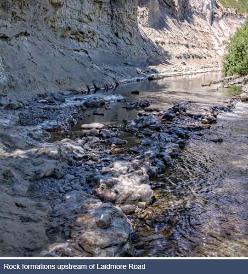
Unformed legal roads or ‘paper roads’ as they are often referred to, are no different in law from formed roads. That is the public have the right to use them on foot, on horse, or in vehicles without hindrance from the adjacent landowner or anyone else. There is a right to assert unhindered passage at all times, however, this right only applies to the unformed legal road and any deviation off the unformed legal road onto private property, is trespassing. In terms of the Waipara River, there is an unformed legal road along the north bank of the river from Stringers Road Bridge to approximately 1.5 kilometres upstream of White Gorge. However, on the field trips it was established that it would not be possible to access White Gorge by vehicle along this unformed legal road due to the topography and effects of erosion.
Esplanade strips and reserves
Section 6 of the Resource Management Act 1991 (RMA) makes provision for the creation of esplanade strips and reserves on land adjoining the river where subdivision has occurred. Esplanade reserves, esplanade strips and access strips, collectively referred to as esplanade areas, are statutory mechanisms to protect riparian and coastal margins. The protection of these margins helps to conserve environmental values and provides opportunities for public access and recreational use.
Esplanade reserves may be required when land is subdivided or alternatively they can be created voluntarily. They are classified as reserves under the Reserves Act 1977 and land ownership is transferred upon deposit of the subdivision plan to the territorial authority. The boundary of an esplanade reserve is measured from the bank of the river and the landward line is a fixed survey line. Accordingly, the landward boundary does not change as the water boundary accretes or erodes. There are two esplanade reserves located adjacent to the Waipara Boys Brigade Camp in the State Highway 1 bridge area. The westernmost reserve is owned by Hurunui District Council with the easternmost reserve being owned by the Department of Conservation.
An esplanade strip is a form of easement over water margin land, created in favour of the territorial authority. They are usually created at the time of subdivision and are a width of 20 metres or less. The easement is registered on the certificate of title, but the land within the strip remains in the ownership of the land owner. Therefore an esplanade strip does not extinguish AMF rights. Although identified on a survey plan, they do not need to be formally surveyed. The creation of a strip, and restrictions and requirements relating to its use and management, are noted on the title and bind every party having an interest in the land. The form of the agreement and standard restrictions to be imposed on esplanade strips are defined in Schedule 10 of the RMA. This specifies that the following acts are prohibited on the land over which the esplanade strip has been created
(a) Lighting any fire:
(b) Carrying any firearm:
(c) Discharging or shooting any firearm:
(d) Camping:
(e) Taking any animal on to, or having charge of any animal on, the land:
(f) Taking any vehicle on to, or driving or having charge or control of any vehicle on, the land (whether the vehicle is motorised or non-motorised):
(g) Wilfully damaging or removing any plant (unless acting in accordance with the Biosecurity Act 1993):
(h) Laying any poison or setting any snare or trap (unless acting in accordance with the Biosecurity Act 1993).
Esplanade strips can include provisions to exclude access by the public during certain times or under certain conditions. Unlike esplanade reserves, the width of an esplanade strip remains unchanged within the same allotment. So if a river bank is eroded by 2 metres, the width of the esplanade strip then extends beyond its old boundary by 2 metres to offset the lost ground.
Under the RMA, esplanade reserves or strips are mandatory in the case of subdivision to lots of less than four hectares. No compensation is payable to the landowner, as the benefits accruing from the subdivision can be seen as compensation for the reserve or strip that is taken.
The Hurunui District Plan provides for the establishment of esplanade reserves or strips in respect of subdivision of four or more hectares along the Waipara River. However, the RMA requires that compensation must be paid to the landowner. The requirement for compensation greatly limits the likelihood of the creation of esplanade reserves, or strips on subdivision of lots of four hectares or more. Furthermore, the provision of a 20 metre wide esplanade strip along the margins of the Waipara River is not practicable in many instances given the topography of the land adjoining the river.
Access strips
Access strips are created by an agreement between a territorial authority and a landowner, and are easements over land for a defined purpose and for specific users, rather than for general public access. They are similar to gazetted walkways in that they are surveyed, recorded on the certificate of title and do not move if the waterway moves, and ownership remains with the landowner.
Private land
The terms of access over private land are a matter for negotiation, and landholders have the right to refuse access or to apply conditions. If somebody is interfering with the rights of an occupier of land by entering their property, there are remedies under the Trespass Act 1980. Disturbing domestic animals; setting traps; opening and leaving open a shut gate, or unfastening and leaving unfastened a fastened gate, or shutting and leaving shut an open gate on private land; are all offences under the Trespass Act 1980.
The process for dealing with trespassers under the Trespass Act includes giving a warning to a person who is trespassing. If the person then refuses to leave, they commit an offence against the Act. However, the offender has several defences, such as proving that it was necessary to remain for their protection or to protect someone else. If the person has left the property then, to prevent future trespassing, a trespass notice should be served on the person (this is referred to in the Act as a “warning to stay off”). Once someone has been given a warning to stay off, they commit an offence if they enter the property within two years and may be prosecuted. The process for serving a trespass notice is set out at www.police.govt.nz/safety/home.trespassnotice.html.
Access users who are on private land without permission must be warned before they commit a trespass offence. Because of the difficulties in knowing where property boundaries are on the ground, it may be hard to determine whether or not trespass has actually occurred.
Where we are now
The research and consultation undertaken both prior to and during the development of this strategy has identified the key issue with regard to access rights and privilege is that adjoining landowners with AMF rights would like users of the river to respect their private property rights. Some landowners feel that if the public want access to their property, then the relevant landowners should be asked for permission to access their properties. A number of submissions to the draft Strategy noted that getting landowner approval from all adjoining landowners would be difficult and onerous in terms of knowing who to contact and how to contact them. Additionally, as mentioned above, it can be difficult to determine on the ground whether you are on private land or publicly accessible land.